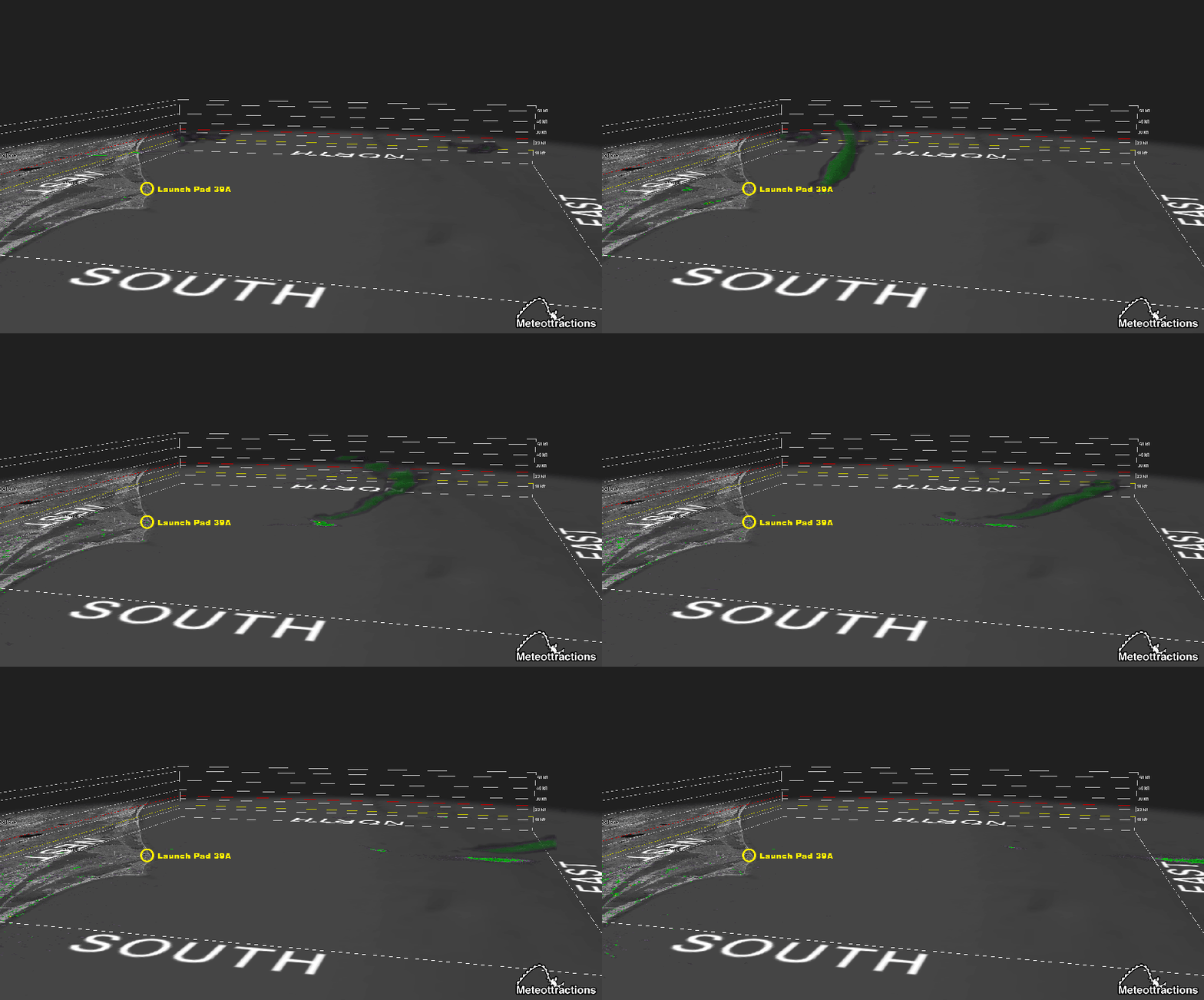
We’ve written before about how our area benefits from an unusually dense network of weather data sensors installed primarily to help monitor weather conditions in support of spaceflight from Cape Canaveral and Kennedy Space Center. Today, one of the most familiar weather sensors gave us a unique view of the SpaceX Falcon 9 Launch Escape test. And it’s just as well that we could see it this way… heavy cloud cover in the Attractions area meant we only got a one or two second glimpse before the rocket slipped behind the clouds.
SpaceX launched its Falcon 9 rocket earlier today from Pad 39A, with the sole intent of safely jettisoning the capsule that would normally carry crew Members… and then letting the rocket sort itself out later (what SpaceX likes to call a RAPID UNSCHEDULED DISASSEMBLY, more commonly known as an earth-shattering kaboom or a big ol’ explosion). The idea is that if something unpleasant were to occur with the rocket itself during a crewed launch, the capsule containing them could separate from the exploding rocket and let the crew splash safely back down to earth.
You can see video of the test here (the good stuff starts around 19 minutes in)…
Of course, launching a rocket produces a giant plume of superheated gasses and leaves a large “cloud” trail that looks very similar to a large jet contrail. Blowing one up amplifies this a bit with the addition of debris. Enter the weather radar.
The National Weather Service’s primary radar site which covers the Attractions area sits near the east coast of the state adjacent to the Melbourne airport, about 30 miles south-southwest of the launchpad. So it’s well-positioned to pick up radar returns from the launch. To the radar, the launch looked very similar to rain (although the latest Dual-Polarity radar technology does allow the radar to tell the difference… just not on the green-yellow-red “reflectivity” mode that you’re used to seeing when you look at the radar to see if rain is on the way).
The radar doesn’t just scan one level of the atmosphere either… it scans a low level… tilts just a little higher and scans again… tilts higher again and scans again… over and over. And with the right software, you can slice through these stacks of data, much like cutting a slice of cake and looking at the layers. Or, you can turn them into a 3D image, which shows you the entire picture much like it would have been if you were there looking at it in person. Here’s what the Melbourne radar saw this morning in 3D. And you don’t even need your MUPPET*VISION glasses to see it.

We suggest you click the image to see it full size… it loses a good deal of its quality when it’s squeezed onto this page.
You’ll notice the sudden burst just offshore, followed by the aftermath of the launch drifting eastward as the prevailing wind carries it out to sea. You might even notice the tilted bow shape it gains within a few frames, suggesting that the upper-level winds are stronger than the sea-level winds, meaning the particles higher up are being moved faster than those lower to the ocean’s surface.
Today’s test was an important signpost along the way on SpaceX’s journey toward crewed flight, ensuring they have a way to safely escape a malfunctioning rocket. And for the weather dweebs of Central Florida, it’s a fun chance to use our hobby to see the launch in an entirely different way… especially when the #$&%#*%# clouds block our view.
