

The National Hurricane Center’s Thursday (7/1) 11AM update has placed the Attractions Area just barely within the cone of uncertainty. The size of the cone is based on prior errors in previous storm forecasts; the NHC has also cautioned that for this system in particular, long-range uncertainty is even higher than usual due to its high forward speed and any potential impacts with landmasses along the way.
Illustrating this uncertainty is the wide range of forecast models, colloquially known as Spaghetti Models, which show various paths based on minute changes in conditions along the way. Depending on the model, run, and other parameters, models suggest landfall as far west as Louisiana, and as far east as near Bermuda. One outlier even suggests the storm could bypass the Gulf of Mexico entirely and wind up in the Pacific Ocean.
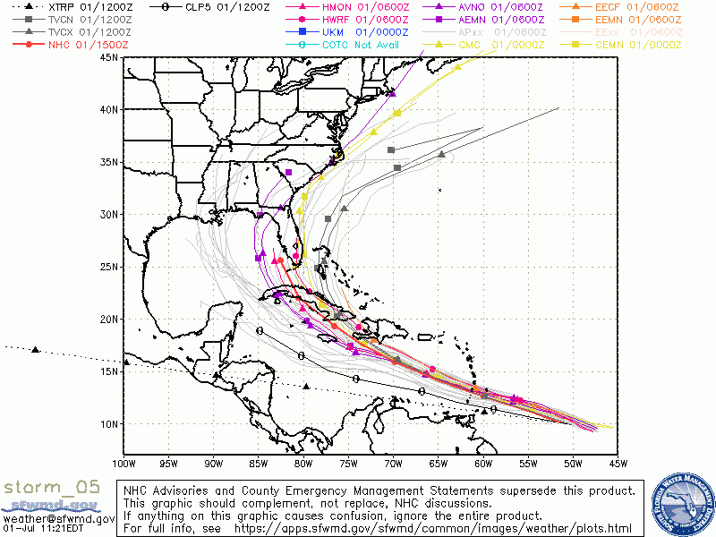
The duty of the NHC is to review these wildly divergent models and determine which to disregard and which to rely upon. These and other factors are reviewed, and the NHC releases its findings as an official forecast track and cone. As always, the track and cone become more certain as time passes; the track can and will change prior to landfall, possibly with the Attractions Area leaving and re-entering and re-leaving the cone over time. For now, the Florida guidance from the NHC is this:
There is a risk of storm surge, wind, and rainfall impacts in the
Florida Keys and portions of the southern Florida Peninsula early
next week. However, the forecast uncertainty remains larger than
usual due to Elsa's potential interaction with the Greater Antilles
this weekend. Interests in Florida should monitor Elsa's progress
and updates to the forecast.
Keep an eye on the forecast as the holiday weekend approaches, and in the meantime… Keep Calm and Carry On!